Discover roads worth a detour.
12,000+ roads rated corner by corner. String them into a drive, or let Joyride Engine build one. Then a co‑driver in your ear calls every corner before you get there.
Free to explore, share and save every road.
How it works
Find a road. Plan the drive. Let the co-driver call the corners.
Find a road worth the detour
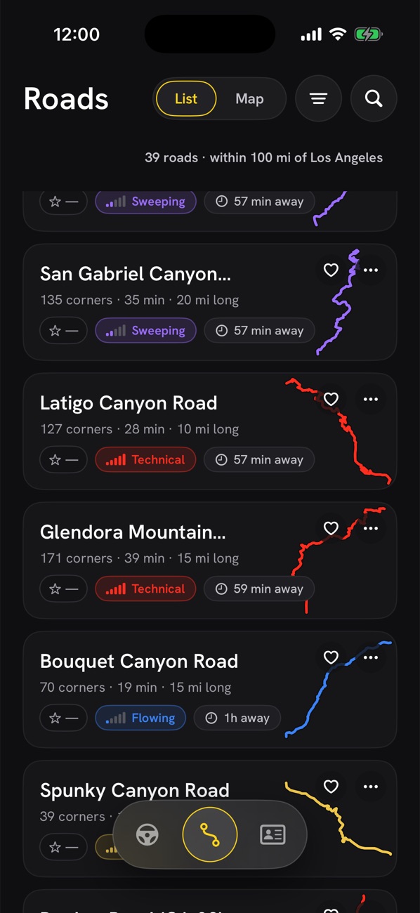
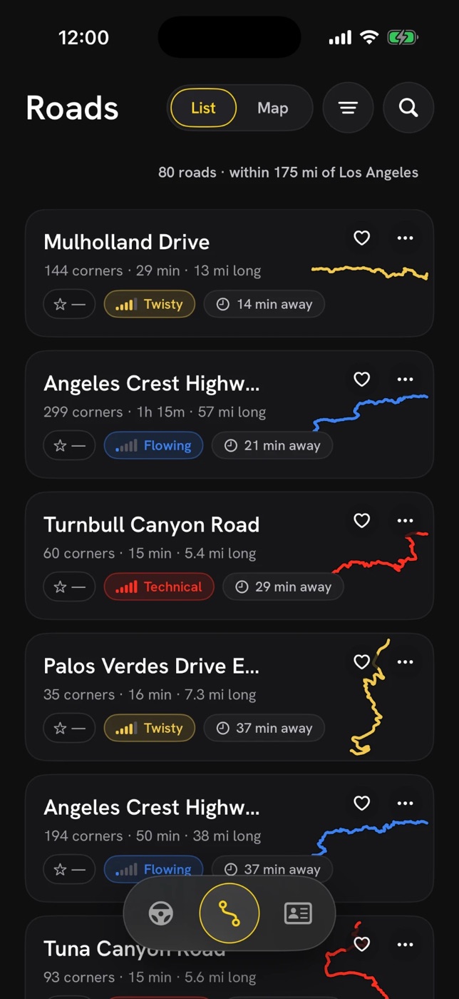
Every road is rated Flowing to Technical from its real corner geometry, with corner counts, elevation, surface and how far away it is. Filter by rating and distance, or search the whole catalog.
Plan the drive
String your favorite roads together into one drive, or set a start and finish and let Joyride Engine build the perfect loop for the time you have.
Drive it with a co-driver
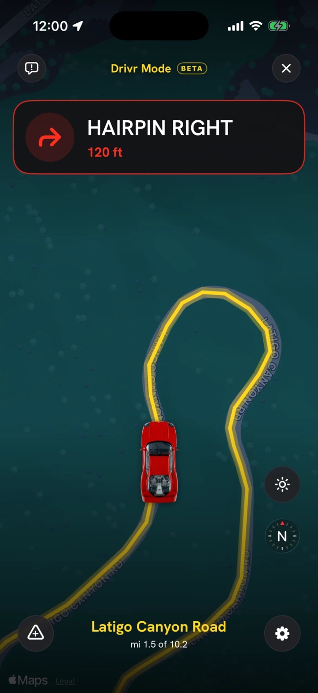
A Drivr Briefing covers hazards, weather and ETA before you roll. Then Drivr Mode calls every corner, turn and reported hazard so your eyes stay on the road.
Roads
Discover, save and share the best roads near you.
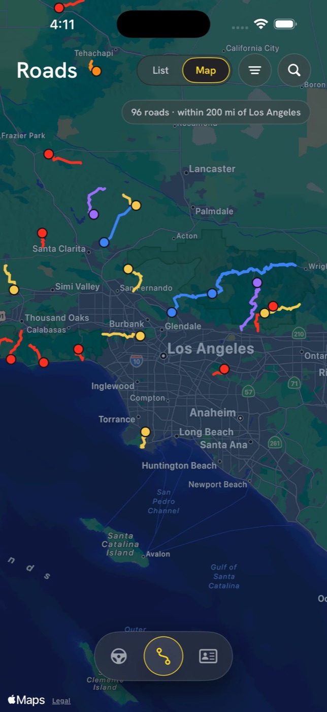
Every corner on every road is measured by its turning radius and sorted as open, medium, tight or hairpin, then the road earns its rating from Flowing to Technical. Browse as a list or on the map, near you or anywhere in the country, and favorite the keepers.
- 12,000+ roads across all 50 states and DC, bundled with the app so browsing works without a signal
- Filter by rating, distance and rural-only, or search by name and region
- Star ratings and comments from drivers who’ve actually driven it
- Share any road as a link that opens straight in drivrmaps
Roads · Detail
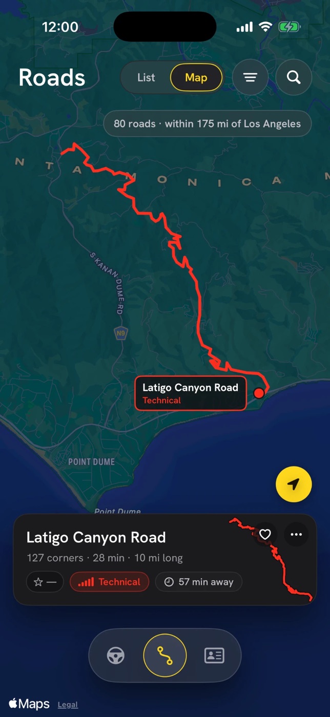
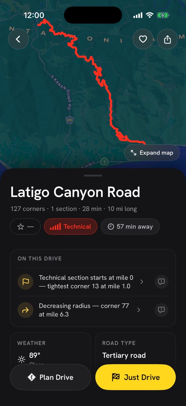
Know the road before you turn in.
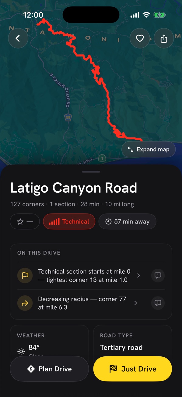
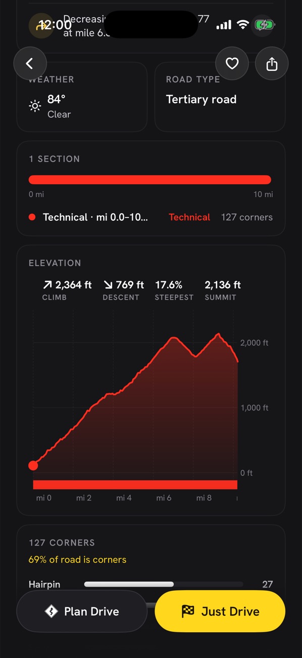
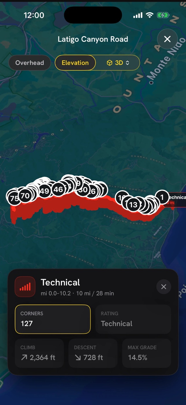
Where the technical section starts and where the tightest corner waits. The full elevation profile with climb, descent and max grade. A 3D view of the road with every corner numbered. Weather on the road right now and the hazards mapped along it.
- Sections rated on their own, so a long road shows where the good part is
- Decreasing-radius corners flagged by number and mile marker
- Overhead, elevation and 3D map views, with every corner you can tap
- Plan Drive or Just Drive from the bottom of every road
Drives Pro
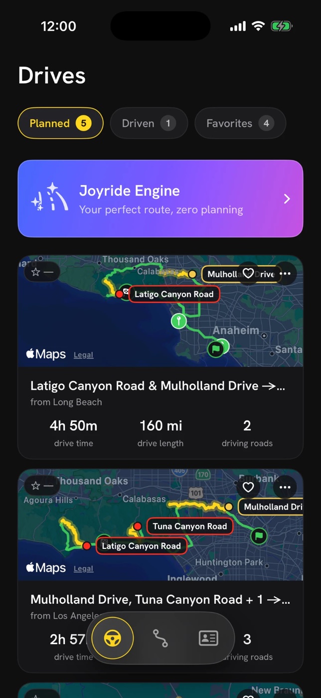
String your favorite roads together to create the perfect drive.
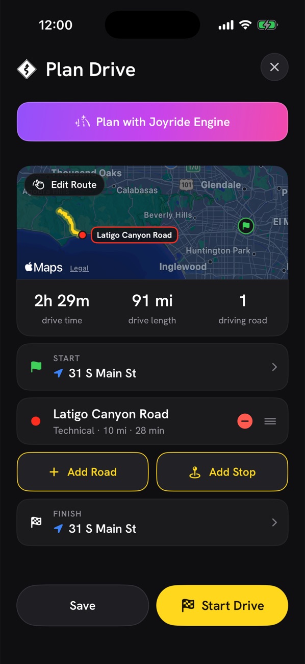
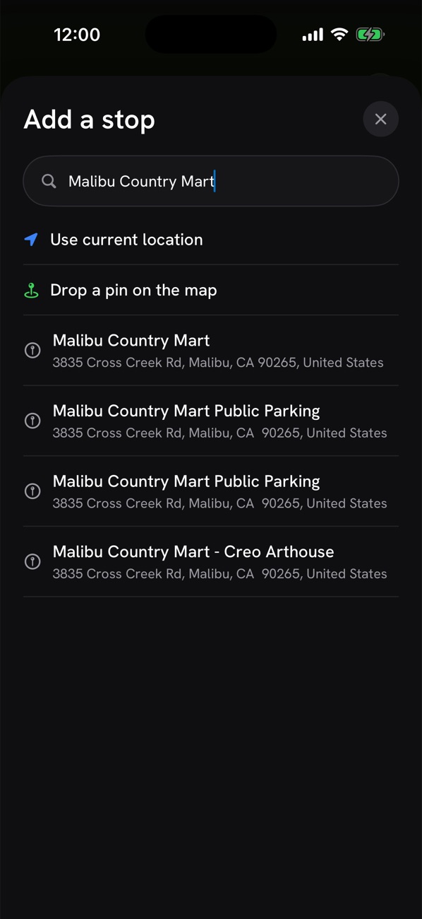
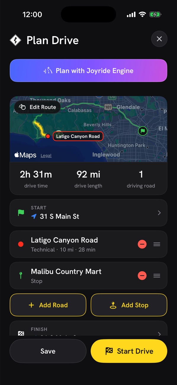
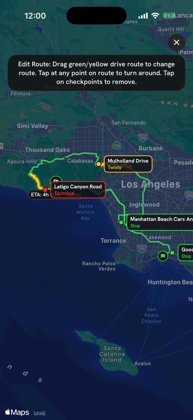
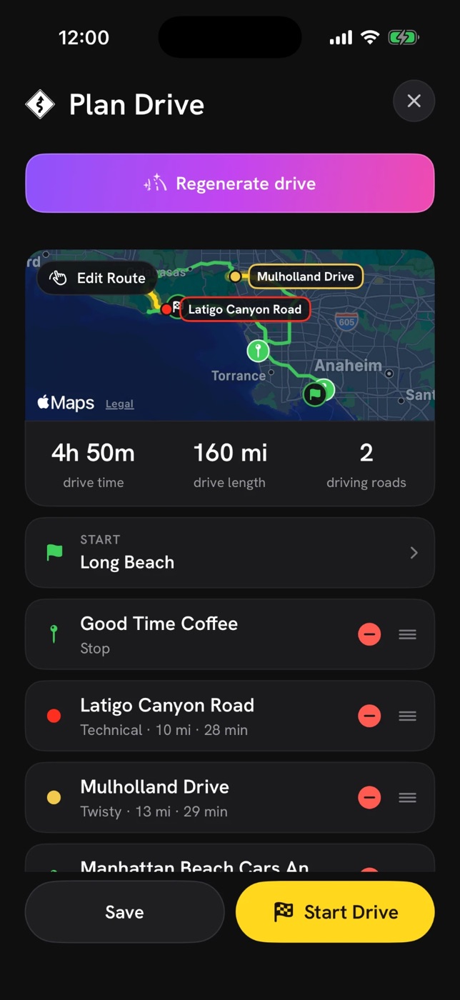
Pick a start, add the roads you want to hit and the stops along the way, drag to reorder, and drivrmaps routes it all into one drive with the time and mileage up front. Planned, driven and favorite drives live in one place.
- Add roads from the catalog, add coffee or car-meet stops, drag to reorder
- Edit Route by dragging the line on the map, tap any point to turn around
- Planned, Driven and Favorites tabs so the Sunday loop is one tap away
- Share a drive as a link; it opens in drivrmaps for your buddies
Joyride Engine Pro
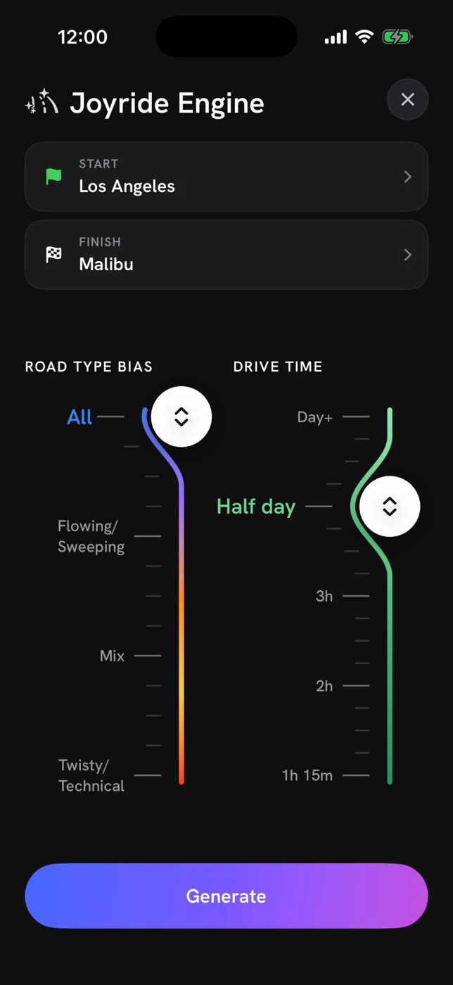
Set your start and finish. Joyride Engine builds the perfect drive.
Tell it where you’re starting, where you want to end up, whether you’re in the mood for flowing or twisty, and how long you have. Joyride Engine strings the best roads in reach into one drive. Don’t love it? Regenerate.
- Road type bias from All to Twisty/Technical, drive time from an hour to a full day
- Drive time, length and every leg laid out before you commit
- Regenerate for a different take, or edit the result like any other drive
- Save it to Planned, or Start Drive right away
Drivr Briefing Pro
Know what to expect before you roll.
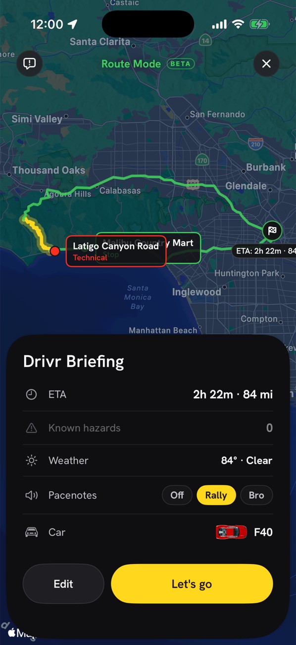
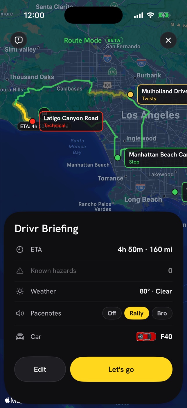
Before the drive starts you get one card with the whole picture: ETA and mileage, the hazards known along the route, the weather on the road, and your pacenote voice and car. Read it, pick your voice, and go.
- Known hazards counted and listed: cattle grids, rail crossings, water crossings, speed bumps
- Weather for the road’s area, with wet-road and ice cautions carried into the drive
- Choose Rally, Bro or no pacenotes, and the car that marks you on the map
- Edit the drive from here if the plan changed
Drivr Mode Pro
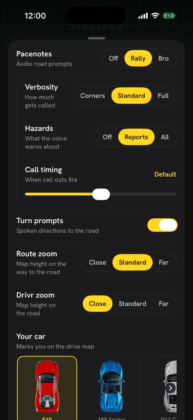
Learn the road with audio pacenotes, route guidance and hazard alerts.
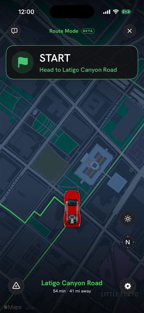
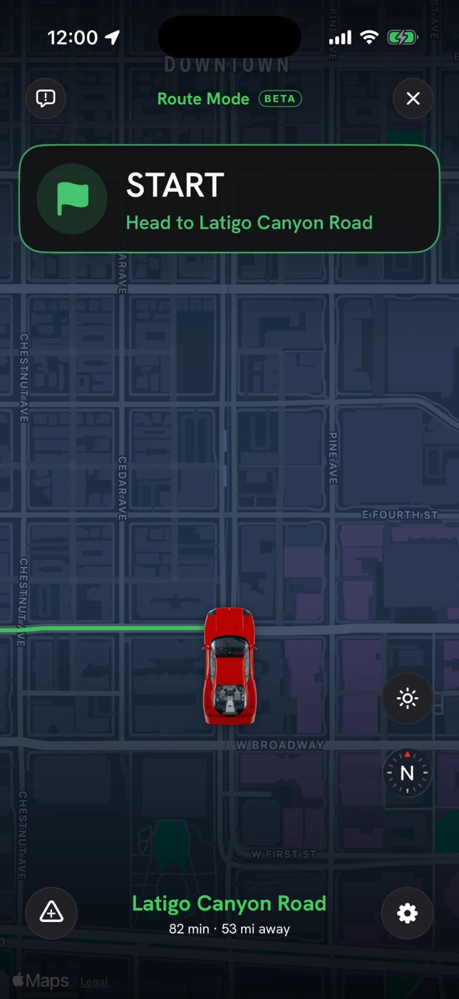
A focused driving experience. Route Mode gets you to the road with spoken turns. On the road, pacenotes call each corner’s direction and severity before you reach it, warn when one tightens, and read out hazards and other drivers’ reports. Eyes up, hands on the wheel.
- Verbosity from corners-only to full, hazard warnings from reports-only to everything, and call timing you can tune
- Report police, accidents and hazards with a tap; nearby drivers hear about them
- Keeps talking with the phone locked; GPS and offline states called out, never silent
- Pick your car: F40, 488 Spider, 911 GT3 RS, E46 M3, Civic Type R and more
Everything else
The details that make it a keeper
Works without a signal
The whole road catalog ships inside the app. Browse, read the corners and check elevation in the middle of nowhere.
Hazards, mapped and reported
Cattle grids, rail crossings, water crossings and speed bumps from the map data, plus live police, accident and hazard reports from other drivers.
Weather on the road
Conditions for the road’s area before you set off, and wet-road and ice cautions in your ear on the way.
Share roads and drives
Send a road or a whole drive as a link. On an iPhone with drivrmaps it opens right in the app, ready to drive.
Your car on the map
Pick your car and it’s the marker in Drivr Mode. E46 M3, 997, GT3 RS, F40, 488 Spider, Civic Type R and more.
Private by design
No ads, no tracking, no third-party analytics. Sign in with Apple only when you save, share or rate, and everything syncs through your own iCloud.

For enthusiasts, by an enthusiast
drivrmaps started as the app I wanted for myself.
Nothing better as a car or moto enthusiast than carving down a new back road on a Sunday morning, or doing a drive with your buddies. I built the road finder, the planner and the co-driver I kept wishing existed. Drive on!

Pricing
Every road is free. Pro turns them into drives.
Browse, rate and share all 12,000+ roads without paying a cent. Pro unlocks drive planning, Joyride Engine, Drivr Briefings and Drivr Mode with pacenotes.
- Every road in all 50 states and DC, with ratings, corners, elevation and 3D
- Weather, mapped hazards and what other drivers reported
- Favorite roads, rate them, share them as links
- No ads, no tracking, ever
- Drives: string roads and stops into one route, edit it on the map
- Joyride Engine: the perfect drive from a start, a finish and a mood
- Drivr Briefing: hazards, weather and ETA before you roll
- Drivr Mode: audio pacenotes, route guidance and hazard alerts
Payment is charged to your Apple ID at confirmation. The trial converts to the annual plan unless canceled at least 24 hours before it ends. Subscriptions renew automatically unless canceled at least 24 hours before the end of the period. Manage or cancel in Settings on your iPhone.
FAQ
Questions, answered
Where do the road ratings come from?
From the road itself. Every corner is measured by its turning radius from OpenStreetMap geometry, sorted as open, medium, tight or hairpin, and the road’s rating comes from the weight of each. Long roads are rated section by section so you can see where the good part starts. Other drivers add star ratings and comments on top.
Do I need an account?
Not to browse. Every road, its corners and its elevation are open without one. Sign in with Apple is asked for the first time you favorite, rate or share, and when you subscribe to Pro, so your drives and subscription follow you between devices through your own iCloud.
Does it work without a signal?
The road catalog is bundled with the app, so finding and reading roads works anywhere. Turn-by-turn routing to the road and weather need a connection; if you lose it mid-drive, pacenotes keep going and the app tells you it’s in straight-line guidance rather than going quiet.
What are pacenotes?
What a rally co-driver reads to the driver: the direction and severity of the next corner before you can see it. Rally voice uses the terse convention (“Right 4, 200… left 2, tightens”). Bro voice says the same thing like a friend in the passenger seat. Both warn when a corner tightens and call out hazards, reports and turns. Six accents to pick from.
Is it safe to use while driving?
It’s built to be listened to, not watched. Set the drive up while parked, then keep your eyes on the road and your hands on the wheel. Pacenotes are a description of the road, not a suggestion of speed. Drive within your limits, the conditions and the law.
Which roads are covered?
Over 12,000 roads across all 50 US states and DC today, rated with the same pipeline everywhere. Coverage keeps growing as more states get a second pass.
What does it cost?
Finding roads is free: the whole catalog, ratings, corners, elevation, weather, favorites and sharing, with no ads and no tracking. Pro is $24 a year (about $2 a month) with a 7-day free trial, or $4.99 billed monthly, and unlocks Drives, Joyride Engine, Drivr Briefing and Drivr Mode with pacenotes. The first 100 paid subscribers lock in their price forever. Road data © OpenStreetMap contributors.
Get drivrmaps
Find a road worth the detour.
Free on iPhone, iOS 26 or later. Every road is open; Pro comes with a 7-day free trial. Pick a road, pick a voice, and go for a drive.